Randburg
Randburg is an area located in the Gauteng province of South Africa. Formerly a separate municipality, its administration devolved to the newly created City of Johannesburg Metropolitan Municipality, along with neighbouring Sandton and Roodepoort, in the late 1990s. During the transitional period of 1996–2000, Randburg was part of the Northern Metropolitan Local Council (MLC).
Randburg was founded as a town in 1959, as the amalgamation of 32 suburbs, northwest of Johannesburg. Although economically linked to Johannesburg, residents chose to create their own town council. The name Randburg was chosen in a competition, and is derived from the South African Rand currency, which was introduced at around the same time that the new municipality was established in 1959. Like other affluent northern suburbs of Johannesburg, the area was regarded as relatively liberal and elected Democratic Party members of parliament. As Apartheid ended, it became more supportive of F. W. de Klerk's reform-minded National Party. In 1962, it became a municipality.
The resident demographic of Randburg tends to be more affluent than most of Johannesburg. The area was declared as a white area during the Apartheid era, but post-apartheid has attracted a varied population. In 2001, it was still predominantly occupied by white English and Afrikaans suburbanites.
Map - Randburg
Map


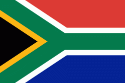
Country - South_Africa
 |
 |
| Flag of South Africa | |
About 80% of the population are Black South Africans. The remaining population consists of Africa's largest communities of European (White South Africans), Asian (Indian South Africans and Chinese South Africans), and multiracial (Coloured South Africans) ancestry. South Africa is a multiethnic society encompassing a wide variety of cultures, languages, and religions. Its pluralistic makeup is reflected in the constitution's recognition of 11 official languages, the fourth-highest number in the world. According to the 2011 census, the two most spoken first languages are Zulu (22.7%) and Xhosa (16.0%). The two next ones are of European origin: Afrikaans (13.5%) developed from Dutch and serves as the first language of most Coloured and White South Africans; English (9.6%) reflects the legacy of British colonialism and is commonly used in public and commercial life.
Currency / Language
| ISO | Currency | Symbol | Significant figures |
|---|---|---|---|
| ZAR | South African rand | Rs | 2 |
| ISO | Language |
|---|---|
| AF | Afrikaans language |
| EN | English language |
| ST | Sotho language |
| SS | Swati language |
| TS | Tsonga language |
| TN | Tswana language |
| VE | Venda language |
| XH | Xhosa language |
| ZU | Zulu language |